


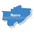
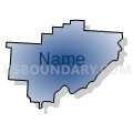
Washington, Morgan, Noble & Monroe Counties PUMA, Ohio
About
Outline

Summary
| Unique Area Identifier | 193735 |
| Name | Washington, Morgan, Noble & Monroe Counties PUMA |
| State | Ohio |
| Area (square miles) | 1,923.81 |
| Land Area (square miles) | 1,902.13 |
| Water Area (square miles) | 21.68 |
| % of Land Area | 98.87 |
| % of Water Area | 1.13 |
| Latitude of the Internal Point | 39.61937360 |
| Longtitude of the Internal Point | -81.46580510 |
Maps


Graphs
Select a template below for downloading or customizing gragh for Washington, Morgan, Noble & Monroe Counties PUMA, Ohio


Neighbors
Neighoring Public Use Microdata Area (by Name) Neighboring Public Use Microdata Area on the Map
- Athens, Gallia & Meigs Counties PUMA, OH
- Belmont & Jefferson Counties PUMA, OH
- Holmes, Guernsey & Coshocton Counties PUMA, OH
- Jackson, Wetzel, Roane, Braxton, Ritchie, Tyler, Gilmer & Calhoun Counties PUMA, WV
- Muskingum & Perry Counties PUMA, OH
- Ohio, Marshall, Hancock & Brooke Counties PUMA, WV
- Wood, Pleasants & Wirt Counties PUMA, WV
Top 10 Neighboring County (by Population) Neighboring County on the Map
- Wood County, WV (86,956)
- Muskingum County, OH (86,074)
- Belmont County, OH (70,400)
- Athens County, OH (64,757)
- Washington County, OH (61,778)
- Guernsey County, OH (40,087)
- Perry County, OH (36,058)
- Marshall County, WV (33,107)
- Wetzel County, WV (16,583)
- Morgan County, OH (15,054)
Top 10 Neighboring County Subdivision (by Population) Neighboring County Subdivision on the Map
- Parkersburg district, Wood County, WV (29,163)
- Marietta city, Washington County, OH (14,085)
- Williams district, Wood County, WV (13,532)
- District 3, Marshall County, WV (12,042)
- Lubeck district, Wood County, WV (10,887)
- Belpre city, Washington County, OH (6,441)
- Olive township, Noble County, OH (5,852)
- District 2, Wetzel County, WV (5,417)
- District 3, Wetzel County, WV (5,366)
- Harrison township, Perry County, OH (5,253)
Top 10 Neighboring Place (by Population) Neighboring Place on the Map
- Parkersburg city, WV (31,492)
- Marietta city, OH (14,085)
- Belpre city, OH (6,441)
- Williamstown city, WV (2,908)
- Devola CDP, OH (2,652)
- Woodsfield village, OH (2,384)
- McConnelsville village, OH (1,784)
- Caldwell village, OH (1,748)
- Powhatan Point village, OH (1,592)
- Beverly village, OH (1,313)
Top 10 Neighboring Unified School District (by Population) Neighboring Unified School District on the Map
- Wood County School District, WV (86,956)
- Athens City School District, OH (35,023)
- Marshall County School District, WV (33,107)
- Marietta City School District, OH (24,063)
- Switzerland of Ohio Local School District, OH (17,913)
- Wetzel County School District, WV (16,583)
- Warren Local School District, OH (14,351)
- Morgan Local School District, OH (14,178)
- Franklin Local School District, OH (12,692)
- Rolling Hills Local School District, OH (11,832)
Top 10 Neighboring State Legislative District Lower Chamber (by Population) Neighboring State Legislative District Lower Chamber on the Map
- State House District 91, OH (130,644)
- State House District 96, OH (124,049)
- State House District 92, OH (123,037)
- State House District 94, OH (117,946)
- State House District 93, OH (116,725)
- State House District 95, OH (106,820)
- State House District 10, WV (55,234)
- State House District 4, WV (33,317)
- State House District 9, WV (19,202)
- State House District 6, WV (18,363)
Top 10 Neighboring State Legislative District Upper Chamber (by Population) Neighboring State Legislative District Upper Chamber on the Map
- State Senate District 31, OH (403,786)
- State Senate District 20, OH (357,708)
- State Senate District 30, OH (338,710)
- State Senate District 3, WV (109,227)
- State Senate District 2, WV (101,327)
Top 10 Neighboring 111th Congressional District (by Population) Neighboring 111th Congressional District on the Map
- Congressional District 7, OH (683,371)
- Congressional District 18, OH (653,167)
- Congressional District 6, OH (623,742)
- Congressional District 1, WV (615,991)
Top 10 Neighboring Census Tract (by Population) Neighboring Census Tract on the Map
- Census Tract 9684, Noble County, OH (7,384)
- Census Tract 202, Washington County, OH (6,942)
- Census Tract 217, Washington County, OH (6,012)
- Census Tract 212, Washington County, OH (5,777)
- Census Tract 209, Marshall County, WV (5,299)
- Census Tract 213, Washington County, OH (5,111)
- Census Tract 9660, Perry County, OH (5,032)
- Census Tract 110, Belmont County, OH (5,009)
- Census Tract 106.01, Wood County, WV (4,885)
- Census Tract 9125, Muskingum County, OH (4,871)
Top 10 Neighboring 5-Digit ZIP Code Tabulation Area (by Population) Neighboring 5-Digit ZIP Code Tabulation Area on the Map
- 26101, WV (29,999)
- 45750, OH (27,785)
- 26105, WV (12,333)
- 45714, OH (9,951)
- 43724, OH (9,201)
- 26155, WV (8,823)
- 43713, OH (7,487)
- 26170, WV (6,137)
- 26181, WV (6,127)
- 26187, WV (5,982)